


Gallery-quality prints · Independent artists · Décor to adore


from $ 19


from $ 11
” by Alleycatshirts")

from $ 11
” by Alleycatshirts")

from $ 11
 Vintage US Virgin” by Alleycatshirts")

from $ 11


from $ 11


from $ 23


from $ 12


from $ 14
” by ArtHistory")

from $ 15


from $ 11
” by ArtHistory")

from $ 15
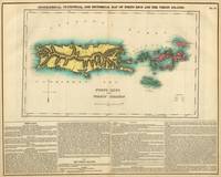
 Map c. 1818” by ArtHistory")

from $ 15
” by ArtHistory")

from $ 15
” by ArtHistory")

from $ 15
” by ArtHistory")

from $ 15
” by ArtHistory")

from $ 15
” by ArtHistory")

from $ 15
” by ArtHistory")

from $ 15
” by ArtHistory")

from $ 15
” by ArtHistory")

from $ 15
” by ArtHistory")

from $ 15

from $ 19
” by ArtHistory")

from $ 15
” by ArtHistory")

from $ 15
” by ArtHistory")

from $ 15
” by ArtHistory")

from $ 15
” by ArtHistory")

from $ 15


from $ 19


from $ 11